 login
loginBlue Ridge Parkway...long..lots o' pics
-
 No new posts


| Moderators: k9car363, the bear, DerekL, alicefoeller | Reply |
 2008-07-28 11:13 AM 2008-07-28 11:13 AM |
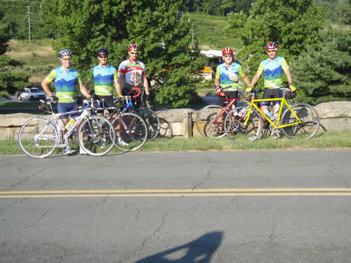
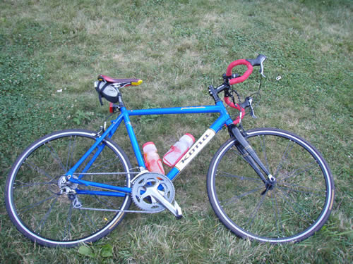
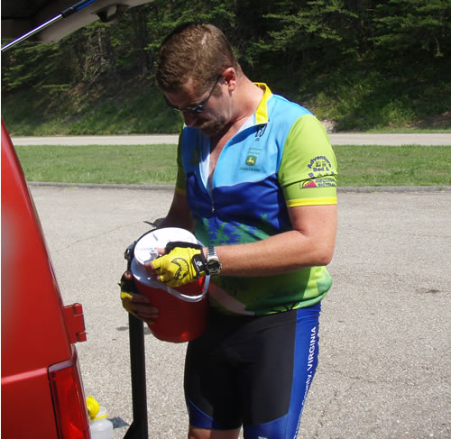
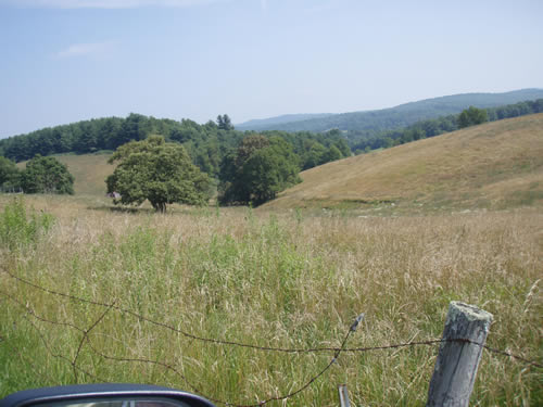
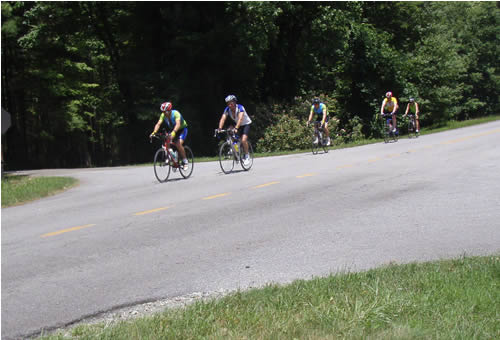
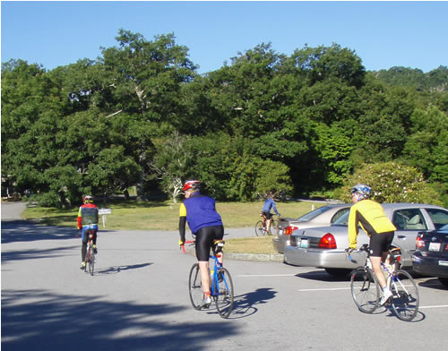
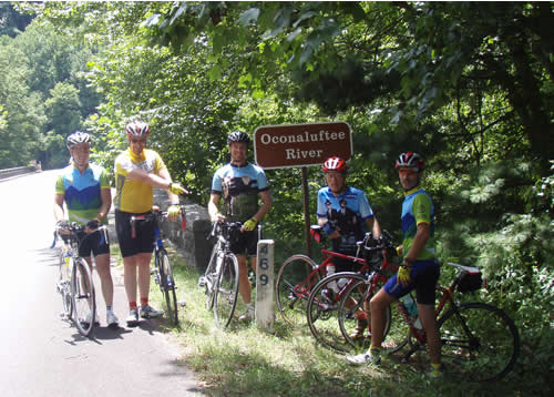
Champion  6786 6786      Two seat rocket plane Two seat rocket plane |  Subject: Blue Ridge Parkway...long..lots o' pics Subject: Blue Ridge Parkway...long..lots o' picsLeaving Waynesboro. Mile zero. The first day was all fun and games for the first 60 miles or so. We all look pretty good here. My trusty steed for the journey, 2008 JTS w/Ultegra SL, and as it would turn out, gearing that is a bit too high... Heading out...
Day one was from Waynesboro to the Peaks of Otter. 86 miles, with 8000+ feet of climbing. Nearly 3000 feet of that climbing was in the last 20 miles. The Thunder ridge climb from the James River up to Apple Orchard mountain goes from 650 feet to 3700 or so.
I began having massive foot pain about 2 miles from the top of the climb, and had to be sagged to the top. that was a bit of a blow, and my foot was goi9ng to be an issue for the next few days, It was 94 degrees when we left the bridge on the James River. The deer at the peaks are very nearly tame, and probably would eat from your hand if you would let them, but that kind of nonsense is frowned upon, and is dangerous for both the deer, and the human. We did throw some bread to the crows, who were most amusing. Day 2 took us from the Peaks to Meadows of Dan. It too was a pretty tough day. I have climbed Bent Mountain from 220 a bunch of times, but never with nearly 40 miles on my legs and the sun beating on my head. we were pretty cooked by the time we got to Smart View for lunch, and the climb up to Rocky Knob at the end of the day seemed like it went on forever. the little rollers afterwards were insult upon injury. On the plus side, we ate dinner in Floyd at Oddfellows Cantina which was excellent. 89 miles 8100 feet of climbing. Sweating at the bottom of Bent Mountain
day 2 profile
One of Dan's meadows??? Day 3 was the toughest on me. the climbing had no really, really big climbs, and the elevation profile is deceptive. Climbing to Doughton Park was hard, and my foot kicked in hard on the last 4 miles. Once again i had to bail and take the van into the Cabins at Laurel Creek. I managed to rally and cook us a good dinner, though. Pasta with tomatoes and mozzarella broiled in a toaster oven. Planned to ride 83 miles, made it for 76.
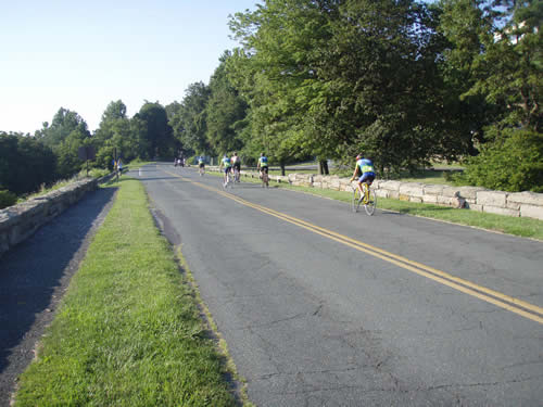
our little peleton On the morning of day 4, I was ot sure I wanted to get back on the bike at all. However, the weather had changed significantly and was much cooler and cloudy. I had my best day yet, and arrived at the first rest stop a couple of minutes ahead of everyone else, instead of off the back. My legs had settled down. more meadows Day 4 took us from Laurel Creek to Little Switzerland. we encountered a longer tunnel than the first one on day 1. It was a little scary. We stayed in the Big Lynn Inn. It's really old-school little cabins and as close to a budget all-inclusive as any place I have ever stayed i the U.S. They make the waitresses in the restaurant dress like some half-assed version of the girl on the Swiss miss hot chocolate package. It had a great view, though and I finally slept fairly well. Today was only a 70 mile ride. profile
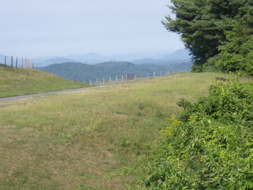
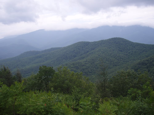
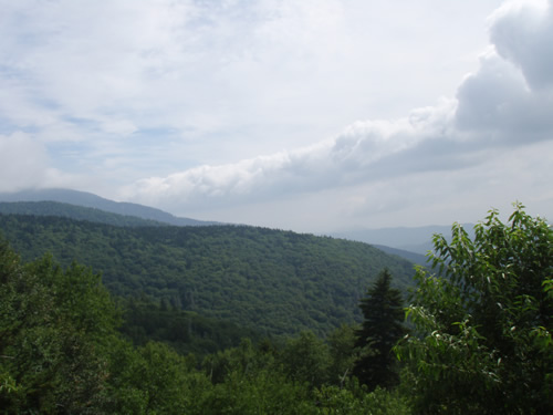
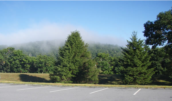
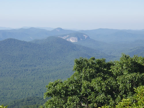
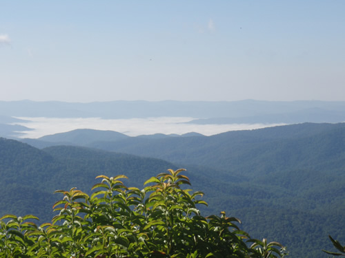
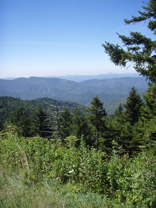
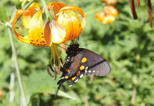
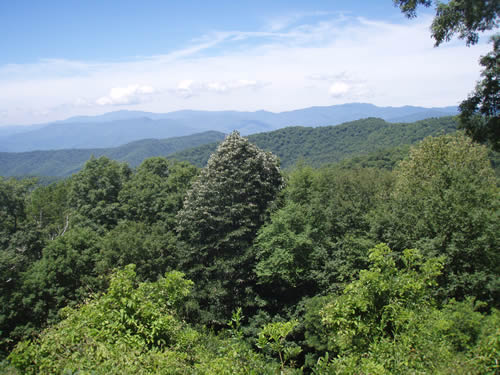
Day 5 took us from Big Lynn to Mt. Pisgah. we were able to ride up to Mt Mitchell, but had to take a long van detour around the mountain because of construction. We only ended up riding 64 miles. we detoured into ashville and took the vans as close to the top as we could. The dascent into Ashville was great, almost a closed course, and very technical due to the curves and the rough pavement. Big fun. traffic around Ashville, though was truly scary, ill-tempered, and just generally the worst. The climb from the French Broad river up to Mt Pisgah is long, hot and difficult, but my foot held out and I arrived at the Inn in pretty good shape. the Inn at Mt. Pisgah has some really, really good food and is so far superior to the one at the Peaks of Otter that they don't even belong in the same paragraph. We got to see lightning from thunderstorms over Brevard in the valley from out porch that night . It was spectacular. Mt Mitchell fogged-in Here's a front rolling in ...probably the one that set off the storms we saw that night Day 6 was only 60 iles from Mt. Pisgah to the end of the parkway, but we would have our most striking scenery here, and a really cool descent from the highest point of the parkway 6300 feet down to about 3200 on us 23. I really enjoyed that. I took off on the descent and came within 1.25 miles of getting over the top of Water rock Knob (2450 climb) first. Alas, my climbing deamon friend caught me at the top and just kept going. Some scenery pice...and butterflys too fog lifting on top of Pisgah Leaving Pisgah, note the cold weather gear. It stayed below 60 for most of the morning above 5000 feet. the looking glass Valley fog Postcard We saw tons and tons of these black butterflys all week the flower is Turks Cap. another postcard We hated to see it end. |


| 2008-07-28 11:18 AM in reply to: #1564257 |
Slower Than You 9566 Cracklantaburbs Cracklantaburbs | Subject: RE: Blue Ridge Parkway...long..lots o' pics GREAT pics. Sounds like a great time, foot pain aside, of course. |
| 2008-07-28 11:25 AM in reply to: #1564257 |
Champion 18680 Lost in the Luminiferous Aether | Subject: RE: Blue Ridge Parkway...long..lots o' pics Sounds like a great ride. |
| 2008-07-28 11:48 AM in reply to: #1564257 |
Elite 4344 | Subject: RE: Blue Ridge Parkway...long..lots o' pics That is a trip I hope to do one day. I have done the climb from the James River to Apple Orchard. I was younger then. TW |
| 2008-07-28 11:55 AM in reply to: #1564257 |
Regular 65 | Subject: RE: Blue Ridge Parkway...long..lots o' pics Looks like an awesome ride. May have to add this to the 'one day' list |
| 2008-07-28 11:59 AM in reply to: #1564390 |
Elite 3022 Preferably on my bike somewhere | Subject: RE: Blue Ridge Parkway...long..lots o' pics tech_geezer - 2008-07-28 12:48 PM That is a trip I hope to do one day. I have done the climb from the James River to Apple Orchard. I was younger then. TW That is a trip I WILL do someday. Great pics - would love to see more. Maybe when I'm ready I'll give you a buzz?... |
| 2008-07-28 12:45 PM in reply to: #1564446 |
Champion 6786 Two seat rocket plane | Subject: RE: Blue Ridge Parkway...long..lots o' pics D.Z. - 2008-07-28 11:59 AM tech_geezer - 2008-07-28 12:48 PM That is a trip I WILL do someday. Great pics - would love to see more. Maybe when I'm ready I'll give you a buzz?...That is a trip I hope to do one day. I have done the climb from the James River to Apple Orchard. I was younger then. TW That's cool. This trip is within reach of any cyclist who's willing to train and plan. Ours was a very agressive schedule, lots of folks take a rest day and others break up the climbs differently. Good support is key too. |
 2008-07-28 12:46 PM in reply to: #1564257 2008-07-28 12:46 PM in reply to: #1564257 |
| Subject: ... This user's post has been ignored. |
| 2008-07-28 1:01 PM in reply to: #1564257 |
| Extreme Veteran 500 On the road...somewhere | Subject: RE: Blue Ridge Parkway...long..lots o' pics My wife and I camped out at Mt. Pisgah a few weeks ago. Tons of bikers. She's from Asheville and we've never riden our bikes there. We both agreed to do it next year. Congrats on the ride. Great pics. |
| 2008-07-28 1:10 PM in reply to: #1564257 |
| Elite 4344 | Subject: RE: Blue Ridge Parkway...long..lots o' pics |
| 2008-07-28 1:15 PM in reply to: #1564756 |
| Champion 6786 Two seat rocket plane | Subject: RE: Blue Ridge Parkway...long..lots o' pics tech_geezer - 2008-07-28 1:10 PM Did you use a polarizing filter or was the sky that clear while you were there? TW All pics taken with a little waterproof point-and-shoot Olympus sw 720....no filters of any kind. The sky on the last day at 5000 feet was shockingly blue and clear....the front had just moved through. We had great weather (too hot on the first two days) but no rain, no morning fog except the one day and it lifted.....and no flat tires. We did have two shifter cables break, though. |
| 2008-07-28 1:45 PM in reply to: #1564257 |
| Subject: ... This user's post has been ignored. |
| 2008-07-28 3:03 PM in reply to: #1564901 |
| Master 2701 Salisbury, North Carolina | Subject: RE: Blue Ridge Parkway...long..lots o' pics Great scenery and great job on the ride. Cupla weeks ago I rode from the Pisgah Ranger Station up 276 to the Parkway. Only 13 miles but the elevation at Parkway was 4542 ft. Quite a hill. |
|
|
|
 View profile
 Add to friends
 Go to training log
 Go to race log
 Send a message
 View album